English| EUR
Suggested for you
More currencies
Choose a language
The via ferrata on Whistler Mountain spans four distinct sections connected by steel cable and anchored traverse points. Each segment climbs a different face, and the full route takes four hours under guide supervision. Understanding the layout helps you prepare for exposure, technical transitions, and the mountain environment.
Quick answer
The whistler via ferrata map covers four alpine sections along Whistler Mountain's western face: the introductory traverse, the vertical pitch, the suspension bridge crossing, and the summit scramble. Steel cables anchor each segment, with transition platforms at altitude. The guided route operates between 09:00 and 17:00 daily, with climbers starting from the mountain lift station and returning via the same descent corridor.
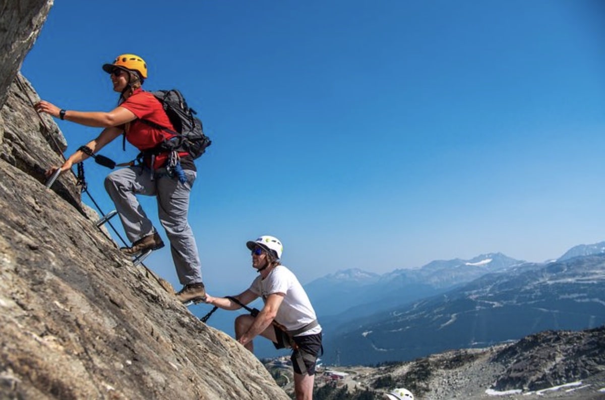
The via ferrata route begins at an elevation accessible only by mountain lift, making the ascent station the mandatory starting point for every climb. From there, the first section follows a shallow traverse across granite slabs, introducing climbers to the carabiner system and the rhythm of clipping into fixed steel cables. This introductory segment covers roughly 200 meters of horizontal distance with minimal vertical gain, designed to build confidence before the exposure increases. The second section introduces the vertical pitch, where the route climbs directly up a rock face using steel rungs and cable anchors. This is the most technical segment, requiring continuous three-point contact and deliberate foot placement. The exposure here is significant—open air below, the valley floor visible through gaps in the rock. Guides monitor each climber's pace and technique, adjusting group spacing to prevent bottlenecks on the narrow ascent. The suspension bridge marks the midpoint. Stretched between two rock outcrops, it sways with each step and offers unobstructed views of the surrounding peaks. This crossing is often the most memorable section, not for technical difficulty but for the visceral sense of height. Beyond the bridge, the route transitions into the summit scramble, a less vertical but more physically demanding segment that weaves through boulder fields and narrow ledges. The whistler via ferrata map shows this final section as the longest by distance, though the gradient eases compared to the vertical pitch. The full circuit returns climbers to the lift station via a marked descent trail, completing the loop without retracing the via ferrata itself. The route's design ensures that even in summer, the rock face remains shaded during morning hours, reducing heat exposure on the steel components. Mountain Skills Academy operates the guided experience daily from 09:00 to 17:00, with the last departure at 13:00 to accommodate the four-hour duration. The lift ticket is separate and required; the 214 CAD guided fee covers instruction, harness, helmet, and safety equipment but not mountain access. Weather can close sections without notice, and the route map remains fixed—there are no alternate paths once the climb begins.
“The suspension bridge sways with each step and offers unobstructed views of the surrounding peaks, marking the midpoint between the vertical pitch and the summit scramble.”
The via ferrata experience follows a fixed progression from check-in at the mountain base through a guided ascent along steel cables and suspension bridges. The complete loop takes approximately four hours with your certified guide.
Arrive at Whistler Mountain's base village and locate the Mountain Skills Academy meeting point. Your guide will verify your reservation and conduct a mandatory safety briefing before distributing harnesses and helmets.
Board the Whistler Village Gondola to reach the via ferrata start zone at mid-mountain. Keep your gear with you; the trailhead is a short walk from the upper gondola station.
Your guide will demonstrate the twin-lanyard technique that keeps you attached at all times. The first ladder section is used to practice clipping through anchor points before beginning the exposed route.
The route ascends through forested cliff bands, two suspension bridges, and a final exposed traverse. Your guide sets the pace and manages transitions at each anchor station.
After the final traverse, the route loops back to a descent trail. The return hike takes 20–30 minutes and exits near the gondola mid-station for your return to the village.
The Whistler Via Ferrata is located on Whistler Mountain. To reach the starting point, visitors must take the Whistler Village Gondola from the base of Whistler Mountain to the Roundhouse Lodge area.
Highway 99 (Sea to Sky Highway) to Whistler Village
BC Connector or private shuttle to Whistler Gateway Loop
Walk from Whistler Village to the Whistler Village Gondola base
Whistler Village Gondola to Roundhouse Lodge
Upon arrival at the Roundhouse Lodge on Whistler Mountain, proceed to the designated meeting point for your guided tour; ensure you have secured a valid mountain lift ticket prior to boarding the gondola.
The Whistler Via Ferrata guided experience operates daily throughout the week. Guests should plan their visits within these established service hours.
The cost for the Whistler Via Ferrata experience is set as a guided tour fee. Please note that this fee covers the guided activity but does not include the mandatory mountain lift ticket required for access.
Verdict: A typical adult pays 214 CAD for the tour, plus the additional cost of a required mountain lift ticket.
The best arrival window for the Whistler Via Ferrata is between 09:00–13:00. This ensures sufficient time to complete the 4-hour guided experience before mountain operations conclude.
Warm, stable, 15°C to 25°C
Long days provide the most flexibility for mountain activities.
Variable conditions, 10°C to 20°C
Early and late season offer fewer crowds but require monitoring weather shifts.
—
Starting early allows for a quieter experience on the route before afternoon lift traffic increases.
Verdict: The optimal time for the Whistler Via Ferrata is weekday mornings during the peak summer months of July and August.
Prepare properly to ensure safe passage on Whistler's alpine via ferrata route.
Everything you need to know about whistler via ferrata map
A physical whistler via ferrata map is not strictly required as all participants must join a guided tour. Your professional guide handles all route navigation and safety protocols throughout the climb.
The climbing route on the mountain is designed to be followed under the supervision of certified guides. You will receive a safety briefing before navigating the steel rungs and suspension bridges using your provided harness and cable system.
Yes, you can book guided excursions through the official site, which provide necessary equipment and expert instruction. These tours are designed to help you explore the high-altitude terrain safely while enjoying the alpine environment.
The guided experience typically takes 4 hours to complete from start to finish. This duration allows for a steady pace across the rocky terrain while ensuring you reach the summit features securely.
The whistler via ferrata map serves as a general guide, but your tour will require a separate mandatory mountain lift ticket for access. Please coordinate your lift transport ahead of time to ensure you reach the meeting point punctually.
You can secure your spot for the climb by visiting the official website. Booking online helps ensure your place on the scheduled tour before you arrive at the mountain.
While a whistler via ferrata map offers context, beginners benefit most from the direct instruction provided by the guides. The route is clearly marked by fixed cables and metal rungs, making it accessible for those with no prior climbing experience.
Whistler Via Ferrata Tour Options
Read more GuideIs Whistler Via Ferrata Dangerous?
Read more GuideVia Ferrata Rating System Explained
Read more GuideWhistler Via Ferrata Reddit Insights
Read more GuideWhistler Via Ferrata Without a Guide
Read more GuideWhistler Via Ferrata Reviews
Read more